The ground itself
Land, towns and resources
The forest country and its rivers, Kumase and the towns, who holds land and how, and what the land gives: gold, cocoa, timber, food and water.
75 sourced entries · every source listed
Go deeper
Geography
Greater Asante at its height: core, provinces and reach
Asanteman (the Asante nation)At its widest, in the late eighteenth and early nineteenth centuries, the Asante state reached far beyond the forest heartland around Kumasi. Historians describe it in layers. Kwame Arhin's…
Note on the sourcespresentThe Ashanti Region today
The modern Ashanti Region is one of Ghana's sixteen administrative regions and sits in the middle belt of the country's south. It covers 24,389 square kilometres, about a tenth of Ghana's…
Note on the sourcespresentUplands, plateau and scarps
Asante lies on a forested plateau. Geographers group the Ashanti uplands with the Kwahu Plateau as the main relief feature of south-central Ghana. Most of the region stands between about…
Note on the sourcespresentRivers of Asante: Pra, Offin, Oda, Tano and Afram
The rivers of Asante rise on the central plateau and part company there. From the north-eastern slopes the Afram and the Pru run to the Volta; from the opposite side the Pra, Birim, Offin,…
presentClimate and vegetation
More than half of the Ashanti Region lies in the wet semi-equatorial forest zone. Its natural cover is moist semi-deciduous forest in the south and centre, grading into Guinea savanna…
Note on the sources1971-presentKogyae Strict Nature Reserve and the Digya margin
The north-eastern edge of the Ashanti Region runs out into the forest-savanna transition and the Afram Plains, and two large protected areas lie there. Kogyae Strict Nature Reserve,…
Note on the sourcesWater and sacred landscape
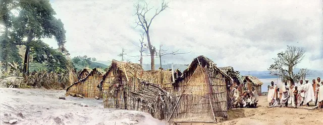 crater formed about 1.07 million years ago
Lake Bosomtwe: a lake in a meteorite crater
BosomtweLake Bosomtwe (also written Bosumtwi) lies about thirty kilometres south-east of Kumasi and is regularly described as Ghana's only natural lake. It fills a crater blasted out by a meteorite…
Note on the sourcestraditional; still observed in partThe sacred lake: beliefs and taboos of Bosomtwe
padua (wooden fishing plank)For the Asante, Bosomtwe is a sacred place. One tradition holds that the souls of the dead come to the lake to take leave of the earth deity Asase Yaa; another, that a deity called Twe…
Note on the sources2016Lake Bosomtwe Biosphere Reserve (UNESCO, 2016)
In 2016 UNESCO admitted Lake Bosomtwe to its World Network of Biosphere Reserves under the Man and the Biosphere Programme; the conservation group A Rocha Ghana reported the decision on 3…
1928-presentOwabi and Barekese: Kumasi's water catchments
Kumasi drinks from two reservoirs north-west of the city. The older is Owabi, where a dam generally dated to 1928 created a small lake that was for decades the city's only piped supply. The…
Note on the sources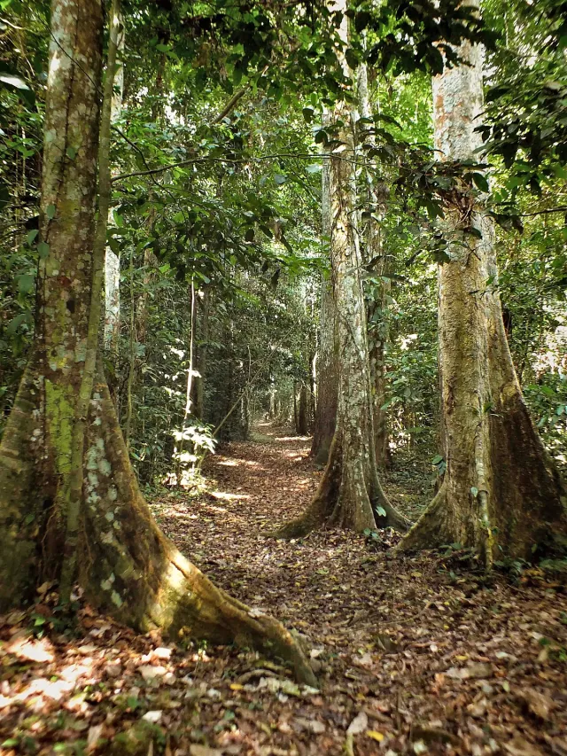 occupied from at least the first millennium CE; present
Asantemanso: the place of origin
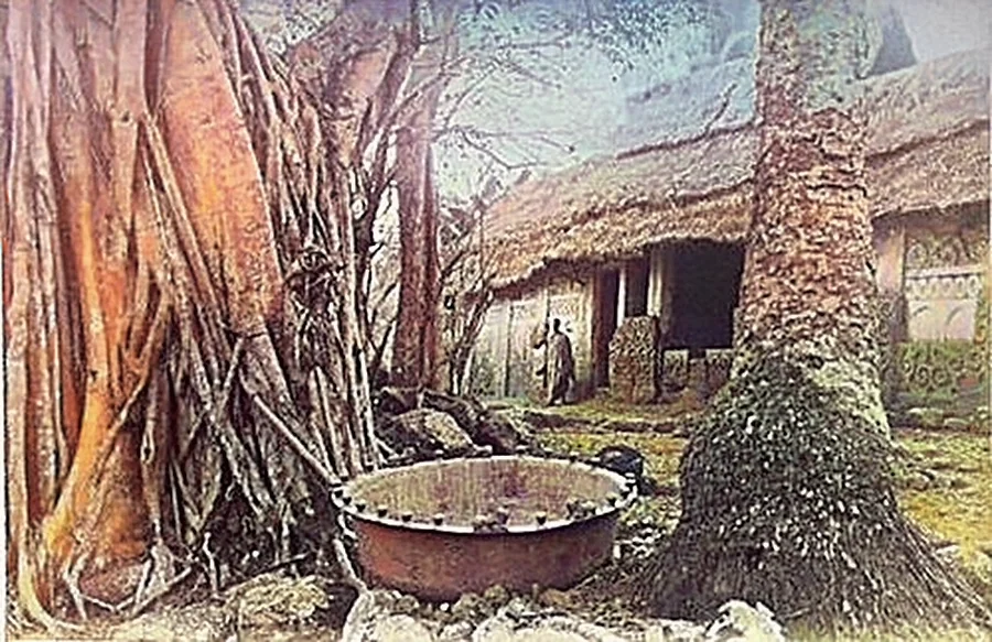
AsantemansoAsantemanso, a sacred grove near Essumeja in the Bekwai area, is the place Asante traditions name as the nation's origin. The best-known account says that the first ancestors came up out of…
Note on the sourcesFarming and forest
Bobiri Forest Reserve and Butterfly Sanctuary
Bobiri is a block of moist semi-deciduous forest about thirty-five kilometres south-east of Kumasi, reached from the village of Kubease on the Kumasi-Accra road. It is run as a research…
Note on the sources1986-presentForest reserves and forest loss
Asante was forest country, and the remaining high forest now survives mostly inside gazetted reserves such as Tano-Offin, Apamprama, Bobiri, Nkrabea and the Afram Headwaters. A satellite…
c. 1900-1930sCocoa comes to Asante
Cocoa was the great change in Asante's twentieth-century economy. The crop's commercial history in Ghana is traced to Tetteh Quarshie, who brought beans from Fernando Po and planted them in…
Note on the sources1947-presentCocobod and cocoa in Ashanti today
Since 1947 Ghana's cocoa has been bought and exported through a state board. The Cocoa Marketing Board was created by ordinance that year and reconstituted in 1979 as the Ghana Cocoa Board,…
Note on the sources20th century-presentTimber: odum, wawa and mahogany
odum (Milicia excelsa); wawa (Triplochiton scleroxylon)The semi-deciduous forest of Asante is the home of West Africa's best-known timbers, and Kumasi has long been the centre of Ghana's wood industry; one source says more than half the…
Note on the sources17th century-presentFood farming: plantain, cocoyam, cassava, yam, maize and oil palm
Before cocoa, and alongside it since, Asante has fed itself from forest farms. T. C. McCaskie describes an economy based from the seventeenth century on staple food farming supplemented by…
18th-19th centuriesKola: the forest's export to the north
bese (kola nut)Kola nuts were Asante's great export to the savanna. The tree grows in the forest; the nuts, a mild stimulant permitted to Muslims, were in constant demand across the Sahel as far as…
Note on the sourcesKumasi
Kumasi: the town under the kum tree
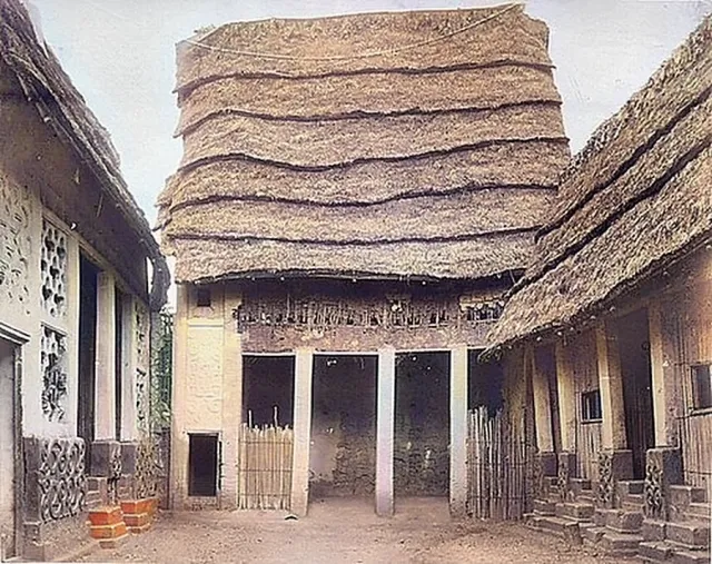
Kumase ('under the kum tree')Kumasi, Kumase in Twi, takes its name from the kum tree. The most widely told tradition says that the priest Okomfo Anokye planted two kum seedlings, one at Kwaman and one at Kumawu, to…
Note on the sources1945-1961The 'Garden City of West Africa'
Kumasi's best-known nickname is the Garden City. Two explanations circulate. The documentary one points to town planning: in 1945 the British modernist architects Maxwell Fry and Jane Drew…
Note on the sources19th century to presentThe wards of old Kumase: Adum, Bantama, Asafo, Manhyia, Ashanti New Town
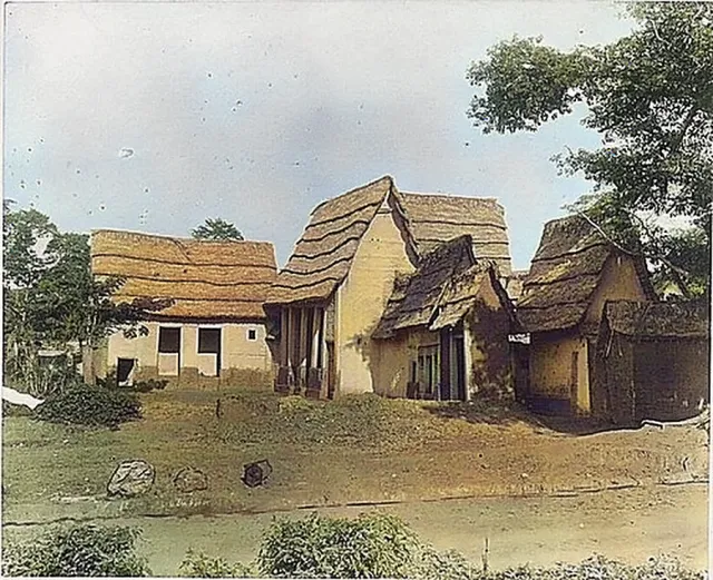
Manhyia (from oman, 'state', and nhyia, 'meeting')Nineteenth-century visitors described Kumase as a city of seventy-seven wards and twenty-seven main streets, with particular wards occupied by particular office-holders, craftsmen or…
Note on the sources1820; rebuilt 1896-97; museum from 1952-53Kumasi Fort and the Armed Forces Museum
Kumasi Fort stands in the centre of the city and now houses the Ghana Armed Forces Museum. According to the Ghana Museums and Monuments Board, the site's history begins in 1820, when the…
Note on the sources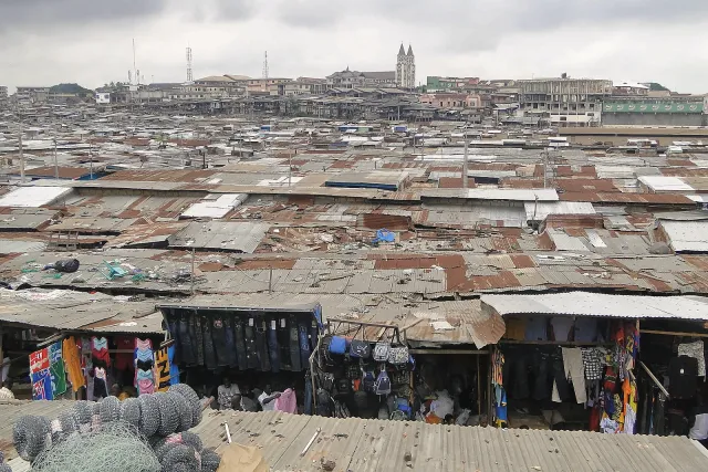 redevelopment 2015-present
Kejetia and Kumasi Central Market
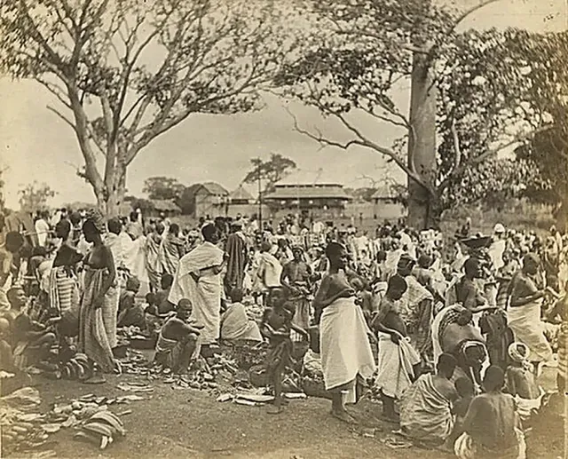
Kejetia, in the heart of Kumasi, grew from a lorry station into the hub of what is often called the largest open market in West Africa, with well over ten thousand stores and stalls. Since…
Note on the sourceszoo: mid-20th century; park opened 2015Kumasi Zoo and Rattray Park
Two green spaces break up central Kumasi. The Kumasi Zoo occupies a wooded site between the Kejetia terminal, the old race course and the Centre for National Culture. It is managed by the…
Note on the sources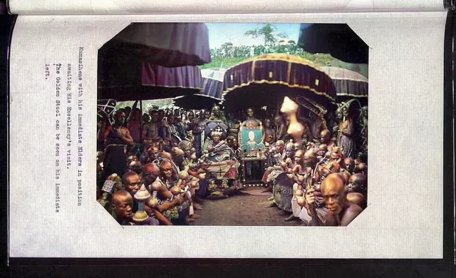 1950s-present
Centre for National Culture and the Prempeh II Jubilee Museum
The Centre for National Culture in Kumasi, long known simply as the Cultural Centre, is a campus of craft workshops, performance spaces, a library and a museum near the zoo. It grew out of…
Note on the sources1951-presentKwame Nkrumah University of Science and Technology
KNUST, on a large wooded campus on the eastern side of Kumasi, began as the Kumasi College of Technology. A government ordinance of 6 October 1951 established the college, and it opened on…
Note on the sources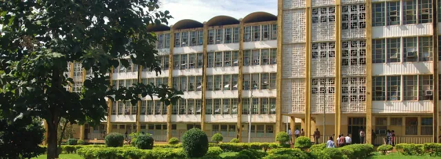 1954-present
Komfo Anokye Teaching Hospital
Kumasi's principal hospital stands at Bantama on ground tied to one of Asante's central legends. The new hospital complex was completed in 1954-55 and first called Kumasi Central Hospital;…
Note on the sources1935-presentBaba Yara Stadium and Asante Kotoko
kotoko (porcupine)Asante Kotoko Sporting Club, the 'Porcupine Warriors', is the football club of Asanteman and one of the most successful in Africa. Most accounts date its formal founding to 1935, when the…
Note on the sources1930s-presentSuame Magazine
Suame Magazine, on the northern side of Kumasi, is one of the largest clusters of informal engineering workshops in Africa. It emerged in the 1930s around a colonial-era armoury, which is…
Note on the sources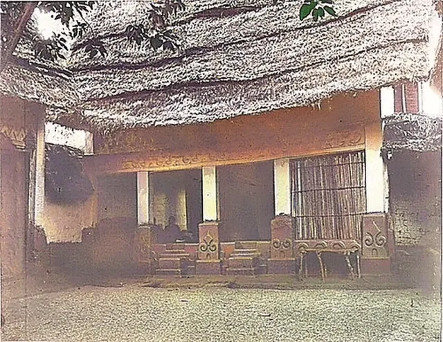 1943-2024
Kumasi's airport, renamed for Prempeh I
Kumasi's airport began in 1943 as a Royal Air Force base. It became a civil domestic airport in 1999. A phased expansion started in 2013: runway rehabilitation and lighting allowed night…
Note on the sourcesPeople and numbers
How many people live in Kumasi?
The answer depends on where the line is drawn. In the 2021 census the Kumasi Metropolitan Assembly area counted 443,981 people. That figure looks small because in 2018 several of the…
Note on the sources2010-2021Population of the Ashanti Region: 2010 and 2021 censuses
Ghana's 2021 Population and Housing Census counted 5,440,463 people in the Ashanti Region: 2,679,914 males and 2,760,549 females. With a national total of 30,832,019, the region held about…
Note on the sources2010-2021Who lives in Ashanti: ethnicity, language and religion
Asante TwiThe Ashanti Region is the homeland of the Asante but has always drawn people from elsewhere. Census-based summaries describe Akan as by far the largest group among Ghanaians by birth in the…
Note on the sourcespresentHow many Asante are there? Numbers and diaspora
Asantefoɔ (the Asante people)There is no agreed count of the Asante people. Ghana's census publishes ethnic totals but the published summaries seen here do not give a single national figure for Asante, and estimates in…
Note on the sourcesTowns and districts
Obuasi: the gold town
Obuasi, about sixty kilometres south of Kumasi in the Adansi country, exists because of gold. The area had been mined by local people for centuries, but the opening of the Ashanti…
Note on the sourceslate 17th century-presentMampong: seat of the Silver Stool
Asante Mampong lies about sixty kilometres north-east of Kumasi on the high ground of the scarp that bears its name. It is the seat of the Mamponghene, occupant of the Silver Stool, who is…
Note on the sources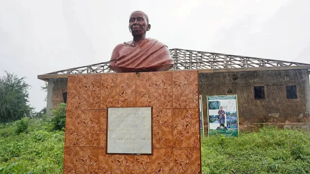 1900-present
Ejisu: Yaa Asantewaa's town
EdwesoEjisu (Edweso) stands on the Kumasi-Accra highway about twenty kilometres east of the capital and is the seat of Ejisu Municipal. Its name is bound up with Yaa Asantewaa, queen mother of…
17th century-presentBekwai
BɛkwaeBekwai lies south of Kumasi and north of Obuasi and is the capital of Bekwai Municipal, a mainly farming district of about 535 square kilometres in which roughly two-thirds of households…
Note on the sources20th century-presentKonongo-Odumasi
Konongo and its twin Odumasi lie about fifty-three kilometres east of Kumasi on the Accra road, in the Asante Akyem country, and form the capital of Asante Akim Central Municipal. Konongo…
Note on the sources 17th century-present
Juaben (Dwaben)
DwabenJuaben, north-east of Ejisu, is one of the five principal founding states of the Asante union. Its rulers are of the Oyoko clan, the same clan as the Asantehene, and tradition brings the…
Note on the sourcespresentOffinso
ƆfensoOffinso lies a short drive north-west of Kumasi on the road to Techiman and the north, near the Offin River from which the wider district takes its character. The Asante name, Ɔfenso, was…
Note on the sources1931-presentAgogo
Agogo is the capital of Asante Akim North, about eighty kilometres east of Kumasi on the edge of the Afram Plains. It is a farming town, with agriculture making up most of the local…
Note on the sources17th century-presentKumawu
Kumawu, capital of the Sekyere Kumawu District north-east of Kumasi, holds a place in the founding story of Asante. In the kum-tree tradition it is the town where Okomfo Anokye's second…
Note on the sources17th century-presentNsuta
Nsuo Ntaa ('twin waters')Nsuta, near Mampong, is the capital of the Sekyere Central District and one of the old states of the Asante union. The Manhyia Archives' history of the union counts it among the kingdoms…
17th century-presentKokofu
Kokofu, in the Amansie country south of Kumasi near Bekwai and Lake Bosomtwe, is one of the Oyoko states at the root of the Asante royal line. Traditions collected by the Manhyia Archives…
17th century-presentBonwire: home of kente
Bonwire, about eighteen kilometres from Kumasi off the Mampong road in the Ejisu-Juaben area, is the town Asante tradition names as the birthplace of kente. The story tells of two friends,…
Note on the sources17th century-presentAdanwomase
Adanwomase, in the Kwabre East area about twenty-seven kilometres north-east of Kumasi, is the other great kente town of Asante and Bonwire's long-standing rival for the honour of being the…
Note on the sourcespresentNtonso: adinkra town
Ntonso, on the Kumasi-Mampong road in Kwabre East, is the centre of adinkra cloth-making. Adinkra are the stamped symbols, each with a name and a proverb, that were traditionally printed on…
presentAhwiaa: the carvers' town
Ahwiaa, a few kilometres north of Kumasi on the Mampong road, is the woodcarving town of Asante. Reference and tour sources describe it simply as a town noted for wood carvings, arts and…
Note on the sourcespresentPankrono: the potters' village
Pankrono, on the same road out of Kumasi as Ahwiaa, is known for pottery. Tour descriptions present it as a place where hand-crafted vessels are made and where visitors can watch the…
presentEssumeja (Asumegya)
AsumennyaEssumeja, also written Esumeja, Asumegya or Asumennya, is a town in Bekwai Municipal and the custodian town of the Asantemanso grove. In the origin tradition it is the first settlement…
1874-presentFomena and the treaty of 1874
Fomena is the capital of Adansi North District and the seat of the Adansihene, paramount chief of the Adansi, an old Akan people whose country lies between Asante proper and the Pra. It…
Note on the sourcespresentTepa
Tepa is the capital of Ahafo Ano North Municipal in the far west of the Ashanti Region, toward the border with the Ahafo Region. The 'Ahafo Ano' districts take their name from the Ahafo…
presentMankranso
Mankranso is a small town on the Kumasi-Sunyani road and the capital of Ahafo Ano South-West District, which was created in 2018 by Legislative Instrument 2323 when the older Ahafo Ano…
presentNkawie
Nkawie, west of Kumasi on the Bibiani road, is the capital of Atwima Nwabiagya Municipal. It was the capital of the former Atwima District before that district was divided, and kept the…
presentEffiduase
Effiduase is the capital of Sekyere East District, north-east of Kumasi between Ejisu and Kumawu. The district dates from the 1988 local-government reform. No further detail specific to the…
late 17th century-presentAgona and Agona-Akrofonso
Agona, about forty kilometres north-east of Kumasi, is the capital of Sekyere South District. With neighbouring Agona-Akrofonso it is among the places most closely tied to Okomfo Anokye.…
Note on the sourcespresentAbono, on Lake Bosomtwe
Abono is the lakeside village where the road from Kumasi, by way of the district capital Kuntanase, comes down the crater wall to the shore of Lake Bosomtwe. Of the thirty or so settlements…
Land and tenure
'The land belongs to the stool': how Asante land is held
asase (land, earth)In Asante customary law the highest interest in land, which lawyers call the allodial title, is held not by individuals but by stools, the offices of chiefs, on behalf of the community of…
Note on the sourcescustomary; restated 2026The Asantehene and the lands of the Golden Stool
Sika Dwa Kofi (the Golden Stool)The Asantehene holds land in two capacities. As Kumasihene he is the direct landlord of Kumasi stool lands, parcelled among the Kumasi sub-chiefs who serve him. As occupant of the Golden…
Note on the sourcespresentThe Asantehene's Land Secretariat
Transactions in Kumasi stool land pass through the Asantehene's Land Secretariat at Manhyia. A chief who allocates a plot issues an allocation paper; the grant then needs the Asantehene's…
Note on the sources1902-2022Kumasi town lands: 1902, 1943, 1958 and after
The land at the centre of Kumasi has changed legal hands several times. After annexation the colonial government took control of the Kumasi town lands in 1902. The Kumasi Lands Ordinance of…
Note on the sources1992-presentArticle 267 and the Administrator of Stool Lands
The 1992 Constitution settles the modern legal status of stool land. Article 267 vests all stool lands in the appropriate stool 'in trust for the subjects of the stool' under customary law.…
1992; reorganised 2008The Lands Commission
The Lands Commission is the state's land agency, provided for in article 258 of the Constitution. Its tasks are to manage public lands and lands vested in the President, to advise…
2020-presentThe Land Act 2020 and customary land secretariats
The Land Act 2020 (Act 1036), assented to on 23 December 2020, gathered Ghana's scattered land statutes into one law. It names and defines the interests that can exist in land: allodial…
presentCommon land disputes in Asante
As Kumasi has spread, farmland on its edge has become building land, and the same kinds of dispute recur. The most common is multiple sale, where a plot is granted to more than one buyer,…
Gold and minerals
Gold before the companies: pits, pans and the state
Gold was worked in Asante long before European companies arrived. It was won in two ways. Alluvial gold was washed from river sands and gravels in wooden bowls, work often done by women and…
Note on the sources18th-19th centuriesGold dust as money
peredwan (largest unit of gold weight)Asante's currency was gold dust. From the early eighteenth century it served as the kingdom's legal tender, a step usually attributed to Osei Tutu's reign, and cowries, the money of the…
Note on the sources1890s-1903Ashanti Goldfields Corporation and the Obuasi concession, 1897
Industrial mining at Obuasi began with African enterprise. In the early 1890s Fante businessmen from Cape Coast, among them Joseph Ellis and Joseph Biney, obtained a concession from local…
Note on the sources1979-2004From Lonrho to Wall Street: the Sam Jonah era
For most of the twentieth century Ashanti Goldfields was a British-run company with the Ghanaian state as a growing shareholder. Its modern transformation is associated with Sam Jonah, who…
Note on the sources2014-2025Obuasi mine: suspension, invasion and redevelopment
By the 2010s the century-old Obuasi mine, deep, labour-heavy and costly, was losing money. Output had fallen from 537,219 ounces in 2002 to 243,000 in 2014, and that year AngloGold Ashanti…
Note on the sourcesearly 20th century-presentKonongo gold mine
The second historic gold-mining centre of the region is Konongo in Asante Akyem. British-owned companies mined there in the colonial period; a production series for Konongo Gold Mines…
Note on the sources2000s-presentSmall-scale mining and galamsey: rivers and farms
Small-scale gold mining is legal in Ghana for citizens holding a licence, but much of it is done without one, and this unlicensed mining is known as galamsey. In Asante it is concentrated…
Note on the sources2024-2025The Asantehene's sanctions against chiefs over galamsey
Ntam Kese (the Great Oath)Otumfuo Osei Tutu II has used his customary authority against chiefs implicated in illegal mining. He has said that chiefs whose lands are invaded by miners will be summoned to explain…
Note on the sources2018-presentBauxite at Nyinahin and other minerals
West of Kumasi, the hills around Nyinahin and Mpasaaso in Atwima Mponua hold one of Ghana's largest bauxite deposits, long known but never mined at scale. The Ghana Integrated Aluminium…
Note on the sources